


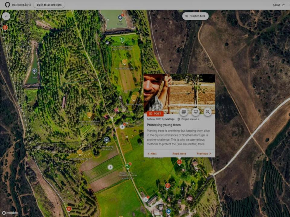


OpenForests’ web map has been a fantastic tool to visualize our reforestation project El Silencio for fundraising.
Fernando Arbeláez

Since engagement in explorer.land, potential clients, and partners are contacting us. It is a wonderful platform with a super-wide network of potential clients and partners. It has helped us a lot in moving forward with our ecosystem restoration activities. Not only because we can prove exactly what we are doing, but it has also put us in contact with various international clients and partners. The platform really works for us.
Paul Burgers, Ph.D.

I really love the mobile UI! I know that challenge from Terrastories, and I think you’ve done an excellent job approaching it. I played around with the page and map, and as before, experienced that everything is as intuitive as I expect it to be. Really great stuff!
Rudo Kemper

An important part of my role at Greenpop is to authentically and transparently communicate the impact of our work to our donors. explorer.land has helped me visually communicate our work. It has combined many of the goals we have for project communications into an easy-to-use platform. The service we have received from the explorer.land team has been exceptional.