Remote Sensing for Carbon Forestry
Remote sensing plays a vital role in modern carbon forestry, enabling accurate and scalable forest monitoring for carbon credit certification and ecosystem restoration. At OpenForests, we integrate cutting-edge geospatial technologies—such as satellite imagery, LiDAR, and drone mapping—to support nature-based carbon projects with transparent, science-based data. From baselining and biomass estimation to long-term carbon stock monitoring, our solutions empower land stewards and project developers to unlock credible, verifiable climate impact.
Remote sensing provides a scalable, cost-effective way to assess forest carbon and land-use change across large and remote areas. By leveraging high-resolution satellite data, LiDAR, and drone-based imagery, carbon forestry practitioners can detect deforestation, monitor reforestation progress, and quantify biomass over time. These tools are essential for establishing reliable baselines, tracking additionality, and ensuring the credibility of carbon credits issued through voluntary and compliance markets. Our remote sensing services are tailored to the specific needs of forest carbon projects, combining spatial analysis with ecological intelligence to deliver actionable insights
How to get started?
Forest carbon standards such as Verra, Gold standard, and Plan Vivo are used to generate carbon credits. Depending on the project type, e.g. reforestation, improved forest management, and avoided deforestation, there are specific requirements for remote sensing and monitoring. We help you to answer the following questions.
1. Which standard for what project type?
2. What is the baseline and historical deforestation?
3. What is the carbon potential?
4. How to monitor changes over time?
All remote sensing work for your project
Together with our clients we select the appropriate methodological frameworks, procure the necessary data, and conduct the required analysis.
Whether you're developing REDD+ projects, monitoring restoration, or verifying carbon removals, our remote sensing expertise supports transparent, science-driven reporting. We help you meet MRV (Monitoring, Reporting, and Verification) standards with confidence—ensuring your forest carbon project meets the expectations of investors, certifiers, and the planet.
Methodology selection
Remote sensing analysis
Continous monitoring
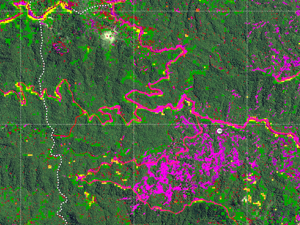
Forest Change Detection
Example of forest classification maps and forest loss detection.
Frequently Asked Questions
What carbon forest standard can you recommend?
Do I need very specific expertise to navigate through the forest carbon certification procedure?
Let’s Build Transparency for Nature Together
Join leading organizations who trust OpenForests to support their transparency, monitoring, and digital storytelling.