Wyss Academy for Nature
The Wyss Academy for Nature is a Swiss organization focused on bridging the gap between scientific knowledge and on-the-ground action, working through regional Hubs to co-design and implement practical solutions for sustainable conservation and human well-being.
In Northern Kenya, it is working hand in hand with local communities to restore degraded rangelands. Its commitment is to turn restoration into shared learning: carefully monitoring, evaluating and sharing results so that others can replicate and adapt the approach.
Tracking how semi-circular bunds restore degraded rangelands in Northern Kenya
Northern Kenya’s rangelands are home to pastoralist communities, elephants and a wealth of biodiversity. Decades of overgrazing, soil erosion and erratic rainfall have left large areas barren, while growing settlements and roads fragment traditional wildlife routes. With its partners JustDiggit and Green Earth Warriors, the Wyss Academy launched a multi-purpose corridor initiative across Laikipia, Isiolo and Samburu counties, where communities dig semi-circular bunds that slow runoff, let rain infiltrate the soil and stimulate natural regeneration.
Started as a local experiment in 2023, the project grew within months from 5,000 to more than 130,000 bunds, covering nearly 800 hectares and involving over 500 households. Conventional reporting could not show what was really happening on the ground. Restoration is slow, complex and sensitive to local conditions, and without visible data it is hard to know what is working or to convince funders and communities that progress is real. The Wyss Academy wanted to make the impact visible, traceable and shareable in real time.
- Integrate multiple data sources: soil sensors, weather stations and satellite imagery
- Turn complex data into clear, intuitive graphs
- Be publicly accessible to foster trust, learning and engagement
- Show recovery season by season, together with the science behind it
Restoring the multi-purpose corridors
Northern Kenya’s rangelands are vast and vital — home to pastoralist communities, elephants, and a wealth of biodiversity. Yet decades of overgrazing, soil erosion, and erratic rainfall have left large areas barren, while growing settlements and roads fragment traditional wildlife routes.
To reconnect these ecological and social systems, the Wyss Academy for Nature launched a multi-purpose corridor initiative across Laikipia, Isiolo, and Samburu counties. The goal: to restore degraded land, revive water flows, and maintain wildlife migration routes — restoring ecosystems and supporting livelihoods.
With the Wyss Academy for Nature’s partners, JustDiggit and Green Earth Warriors, communities are reviving an age-old technique: digging semi-circular bunds that slow surface runoff, allow rain to infiltrate the soil, and stimulate natural regeneration. In a restored (compared to a degraded) landscape, the increase in vegetation cover and soil water content enhances evaporation and atmospheric moisture content, which can lead to shallow cloud formation and sometimes even deep convection, creating a positive feedback on precipitation recycling.

Started as a local experiment in 2023, the project expanded within months from 5,000 to more than 130,000 bunds, covering nearly 800 hectares and involving over 500 households.
As vegetation began to return, new patterns appeared — patches of green and elephants visible even from space.
To track this transformation and communicate it beyond the field, the Wyss Academy turned to OpenForests to make the impact visible, traceable, and shareable in real time.

Why live monitoring?
Conventional reporting often falls short of showing what’s really happening on the ground. Restoration is slow, complex, and sensitive to local conditions. Without visible data, it’s difficult to know what’s working — or to convince funders and communities that progress is real.
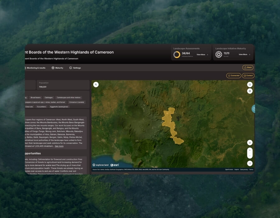
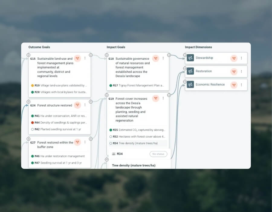
explorer.land, developed by OpenForests, bridges that gap. It combines maps, indicators, and storytelling tools to make nature-based projects transparent and interactive.
For the Wyss Academy team, it offered exactly what was needed:
- Integration of multiple data sources — soil sensors, weather stations, and satellite imagery
- Visual graphs that make complex data clear and intuitive
- Public accessibility to foster trust, learning, and engagement
Today, anyone can visit the project’s monitoring page on explorer.land to explore maps, timelines, and sensor readings — seeing recovery unfold season by season, and understanding the science behind it.

Data collection and scope
To understand how restoration influences soil, vegetation, and climate, the Wyss Academy uses complementary monitoring techniques, combining ground-based measurements with satellite observation for a complete picture of change.
1. Soil sensors: measuring water below the surface
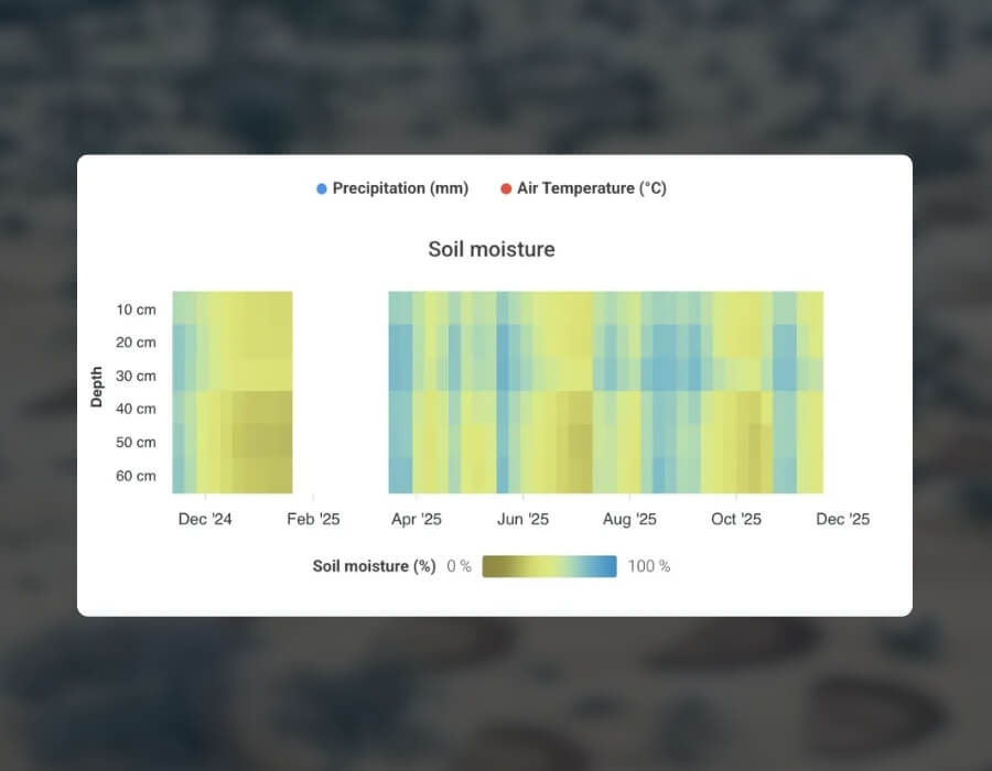
Soil sensors were installed both inside and outside the bunds to capture comparative data on moisture and temperature at multiple depths (every 10 cm). These measurements reveal how effectively the bunds retain water and how soil conditions evolve after rainfall.
2. Weather stations: tracking local climate conditions
Weather stations were installed across the corridor to monitor temperature, humidity, wind, and rainfall. These stations help link ground conditions to broader climatic patterns and provide essential context for interpreting changes in vegetation and water.
3. Satellite monitoring: seeing greening from above
High-resolution satellite imagery, analyzed through NDVI (Normalized Difference Vegetation Index) and made visible on explorer.land, tracks how vegetation responds over time — from seasonal fluctuations to long-term restoration trends.
4. Camera and net traps: monitoring wildlife species

Complex forest data, now an intuitive map-based experience
The first measurements show a clear increase in soil moisture (infiltration) after precipitation in bunds compared to control sites — a strong indicator that the bunds are effective measures for the land to regain its ability to store water.
Over time, this improved retention supports plant growth, boosts transpiration, and may even influence local rainfall — creating a regenerative cycle that strengthens both ecosystems and livelihoods.
On explorer.land, these findings come to life through interactive maps and dynamic graphs, allowing anyone to explore trends, zoom into locations, and witness how restoration is progressing.
For the Wyss Academy’s research teams, the system provides scientific validation.
For local communities, it provides visible proof that their efforts matter, encourages knowledge transfer for upscaling, and supports the development of scientifically-based land management policies, such as grazing plans to reduce pressure on grazing areas.
And for partners worldwide, it offers a replicable framework for transparent, data-driven restoration monitoring.
Scientific validation
The Wyss Academy’s research teams can validate the restoration work with field and satellite data.
Visible proof for communities
Local communities see that their efforts matter, which encourages knowledge transfer for upscaling and supports science-based land management, such as grazing plans.
A replicable framework
Partners worldwide can draw on a framework for transparent, data-driven restoration monitoring.
Live monitoring for restoration in remote landscapes
The greatest lesson so far: monitoring is not just about data — it’s about people. When communities can see their landscape responding through live visuals, restoration becomes tangible, personal, and collective.
By blending traditional wisdom, scientific insight, and digital transparency, the Wyss Academy and OpenForests are demonstrating that technology can amplify trust, accelerate learning, and inspire replication far beyond Kenya’s rangelands.