LandScale
LandScale is a global initiative that helps organisations assess, monitor and communicate sustainability at the landscape level. It was co-developed by the Rainforest Alliance, Conservation International and Verra and is now co-led by the Rainforest Alliance and Conservation International.
Rather than looking at one project or supply chain in isolation, LandScale assesses the landscape as a whole. Its framework covers four areas: ecosystems, human well-being, governance and sustainable production. Landscape initiatives can use the framework to establish a shared baseline, understand their strengths and gaps, track progress and communicate results to partners and funders.
Building on an existing platform while keeping it moving
LandScale already had an established methodology and a functioning digital platform. As the platform evolved through several phases of development, the team saw an opportunity to strengthen its technical foundation and make it easier to maintain, scale and extend with new functionality.
Before adding further functionality, we needed to understand where the main risks and constraints were. We therefore assessed five areas of the platform: business logic, user experience and flows, frontend, backend and database. Each finding was evaluated according to its severity and the effort required to address it.
The assessment identified optimisations ranging from security and data architecture to frontend consistency and everyday content management.
Some small, routine changes also took more effort than they needed to. Updating the platform-wide notification banner, for example, required changes in ten different places and around nine hours of developer work.
The first challenge was to create a stronger foundation for its continued development.
- Retain the project information and indicators already in use;
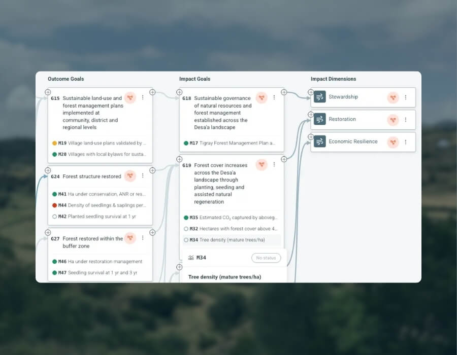
- Show the relationships between activities, outputs, outcomes and impact;
- Show multiple connections instead of forcing each element into a single pathway;
- Connect project-level results with WeForest’s wider strategic goals;
- Make the full logic of the restoration programme easier to explore;
- Support learning, management and communication.
Strengthen the foundation while developing what comes next
Understand the platform first
We began with a structured assessment of the existing platform.
Instead of immediately fixing individual issues, we documented how the different parts of the system worked together and created a shared backlog ranked by severity and effort.
This gave the Rainforest Alliance and OpenForests a common basis for deciding what needed immediate attention, what could be improved gradually and where larger structural changes were required.
The assessment continues to evolve as different areas of the platform are developed.
Make stabilisation part of continuous development
The initial roadmap treated platform stabilisation as a limited phase of work.
Our assessment showed that improving the technical foundation needed to happen continuously alongside feature development. Together with the LandScale team, we adapted the roadmap accordingly.
Technical improvements prioritised platform security, data protection and access controls, alongside work on maintainability and performance.
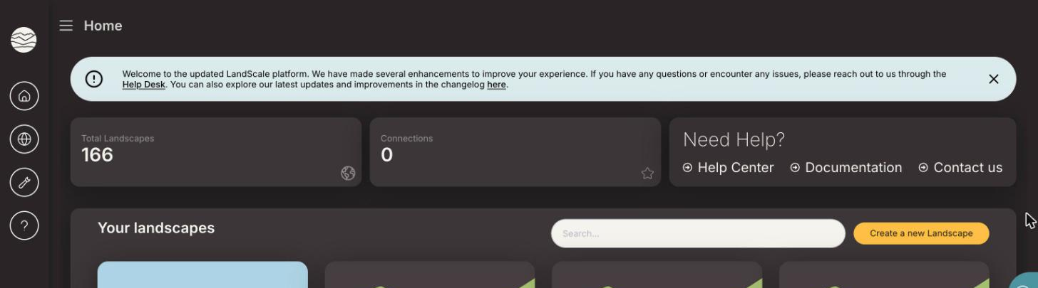
At the same time, we started simplifying everyday platform management. The notification banner that previously required around nine hours of developer work can now be updated in approximately two minutes by a project manager.
Rework the Landscape Initiative Maturity assessment
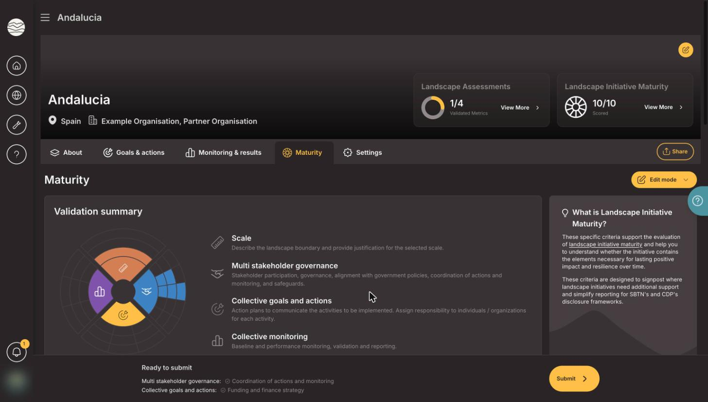
The Landscape Initiative Maturity (LIM) assessment helps initiatives understand how prepared they are to coordinate action and attract support at landscape scale.
It looks at areas including scale, multi-stakeholder governance, collective goals, collective action and monitoring.
We restructured the underlying data model to better separate landscape profiles, goals and actions, migrated existing information into the new structure and redesigned the interface to make the different assessment components easier to understand.
The goal was not just to redesign a form but to create a data structure that can better support future assessments and show how initiatives develop over time.
Give funders a portfolio-level view
Many organisations support more than one landscape.
Previously, information about these portfolios was often managed outside LandScale in spreadsheets and presentations.
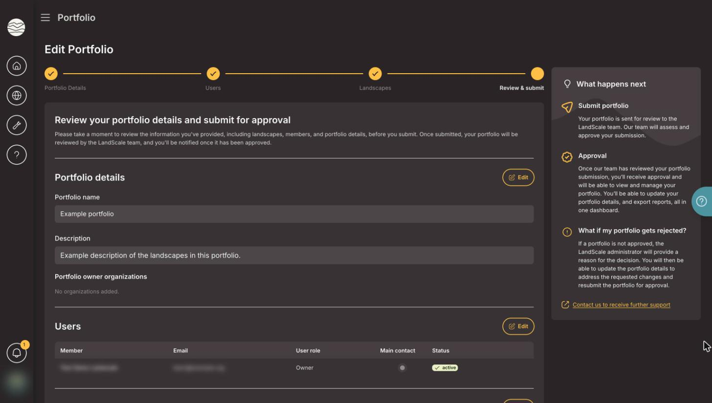
We developed a portfolio feature that brings this information into the platform.
Organisations can now group landscapes into portfolios, record their role in each landscape, track funding information and export the portfolio when needed.
Portfolio owners decide which information remains private and what can be made public.
LandScale administrators also review portfolio creation, helping ensure that relationships between organisations and landscapes are verified.
This adds another level to LandScale: from understanding individual landscapes to understanding groups of landscapes as a portfolio.
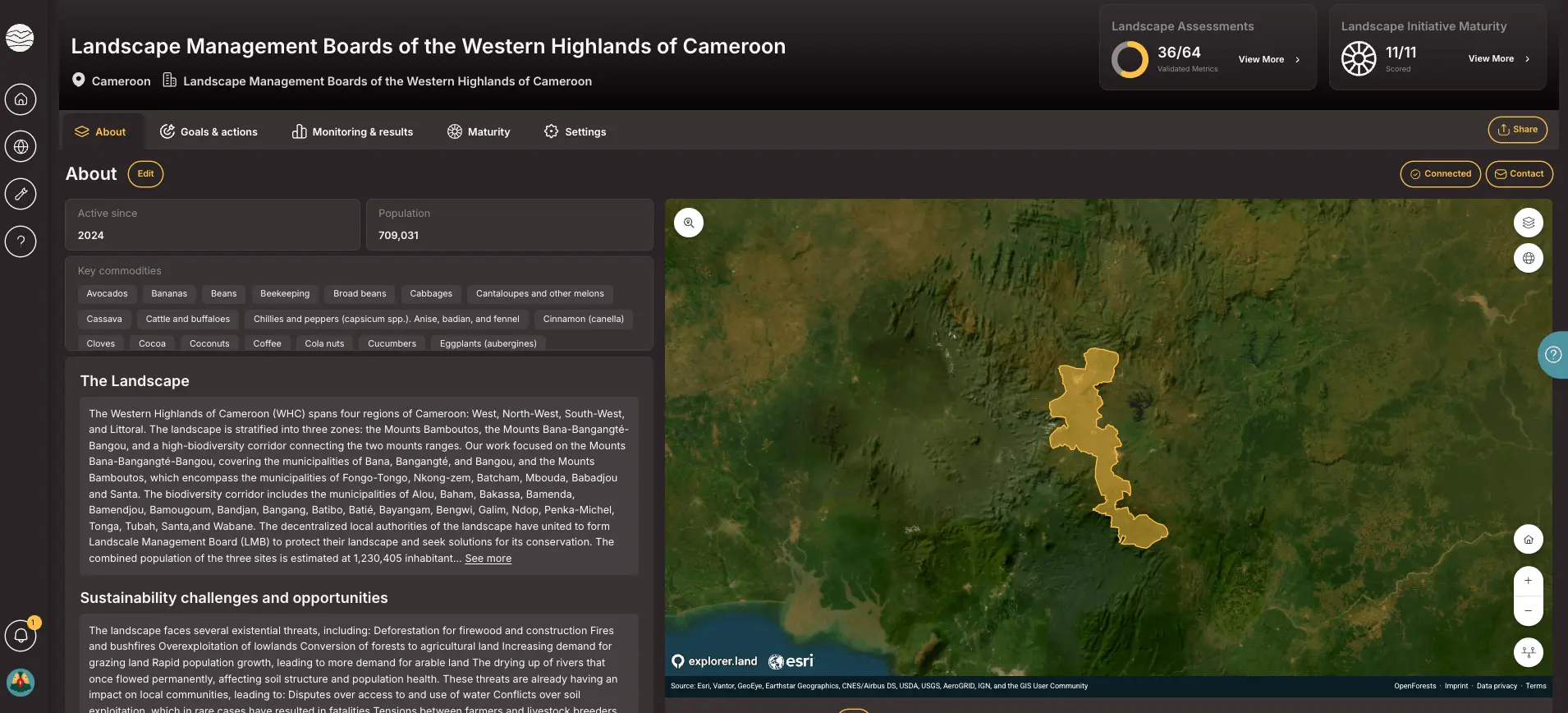
Add geographic context to landscape profiles
A stronger foundation for LandScale's next stage
The work is ongoing, but several important changes are already in place.
OpenForests’ impact monitoring tools help WeForest derive even more value out of years of rigorous monitoring data, helping us form a unified, data-driven representation of our Theory of Change. Our strategic partnership with OpenForests underscores our long-standing commitment to transparency, giving our funding partners a clearer, more credible line of sight from their contribution to the long-term project impact.
Tariq El Haj Omar – Chief Growth Officer, WeForest

Platform security has been strengthened.
Routine content management is simpler.
Support and documentation are more structured
Portfolio management is part of the platform
LandScale and explorer.land are connected
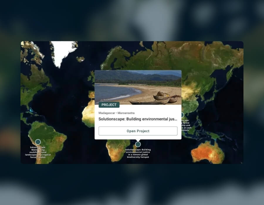
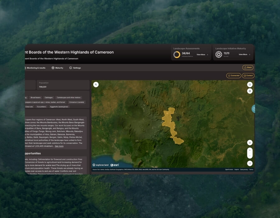
Landscape profiles now include interactive maps that add geographic context
When the methodology works, but the platform needs to catch up
LandScale’s situation is not unusual. Many environmental organisations have digital platforms that have grown over several years, often across different development teams.
The underlying programme, methodology or dataset may still be highly valuable, while the technology has become increasingly difficult to maintain.
Starting again from zero is not always the right answer. A structured technical assessment can show what should be protected, what needs to change and where targeted improvements can create the biggest difference.
For LandScale, this meant strengthening the existing platform while continuing to develop new functionality for landscape initiatives, funders and partners.
This is also how OpenForests approaches inherited environmental platforms more broadly: understand the system first, improve the foundations where needed, and build from there.