Etifor and WOWnature

Etifor is a spin-off of the University of Padua in Italy. It advises companies, public institutions and other organisations on how to understand and value the benefits that nature provides.
Its initiative WOWnature lets individuals and businesses support tree planting and offset part of their carbon footprint through reforestation projects, choosing from different project areas. For WOWnature, OpenForests built custom web maps that show the reforestation locations and connect them to the tree shop.
Helping people see where their support goes
A tree shop makes it easy to buy or sponsor trees, but the transaction alone does not show the landscape behind it. Supporters still want to know where their contribution goes and what the project area looks like.
For WOWnature, the challenge was to connect the online purchase with the physical landscapes where reforestation takes place. The goal was to help people understand the places behind the trees, not only to sell trees online.
- Show where the trees will be planted
- Show what each project area looks like
- Let supporters see which locations they can choose from
- Link each contribution to a real place
A map layer for the tree shop
OpenForests created custom web maps that show WOWnature’s reforestation locations and link them to the tree shop. The map became a bridge between the online shop and the field reality of reforestation.
Showing planting locations on a map
The first step was to make the available reforestation areas visible. Users can explore where the projects are, so each one becomes a real place rather than a product listing.
This gives supporters a stronger connection between their contribution and the landscape being restored.

The WOWnature web map with reforestation project locations across northern Italy.
Connecting the map with the tree shop
The map links directly to the tree shop. Users can discover a project location visually, then go on to support that specific project.
The map does not replace the shop. It adds a transparent entry point into it, bringing storytelling, location and purchase together in one user journey.

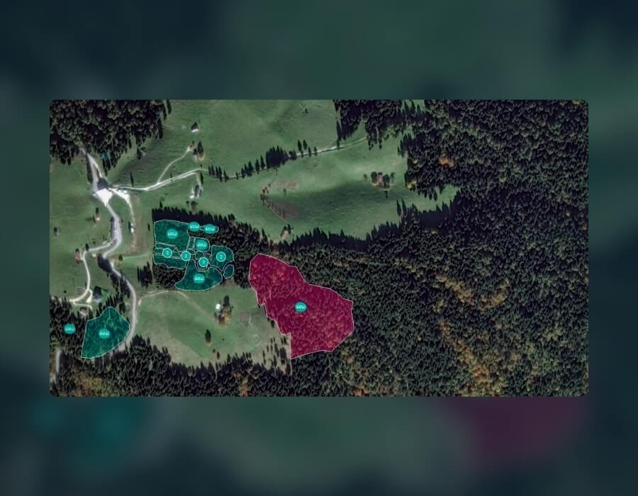
Planting areas outlined on satellite imagery.
Making reforestation tangible for individuals and businesses
Tree planting can easily become a generic claim when it is not connected to place. With the map, people are not only told that trees will be planted. They can see where.
For individuals, this makes the experience more tangible and engaging. For businesses, it offers a clearer way to understand and communicate where the reforestation they support takes place.
A more transparent tree shop experience
WOWnature’s tree shop is now connected to the real-world locations of its reforestation projects.
Projects shown as places
Supporters can see where tree planting projects are located and which landscapes they can choose from.
Trust before the transaction
The map shows how an online contribution connects to a place before anyone buys or sponsors a tree.
More than a product listing
Planting or sponsoring trees feels more tangible, and reforestation is communicated as work in specific landscapes.
Organisations that sell trees or nature-based products
When support for nature is sold online, an interactive map can make the experience more transparent and concrete by showing where each contribution goes.
- sell trees or restoration sponsorships online
- offer carbon contributions through reforestation projects
- want supporters to see project locations before they contribute
Do your supporters know where their contribution goes?
OpenForests helps restoration and conservation organisations map, monitor and report their work.