Hommes & Terre

Hommes & Terre is a Belgian-African organisation that restores degraded land while making sure local communities have sustainable access to fertile land. It combines ecological restoration, sustainable agroforestry and community collaboration, and develops and manages restored landscapes together with local communities.
Its projects focus on degraded common lands, where desertification, soil erosion, declining fertility and pressure on natural resources affect both nature and community resilience. For Hommes & Terre, restoration means more than bringing vegetation back. It means rebuilding the conditions that allow people and ecosystems to thrive together.
Showing the full reality of landscape restoration
Landscape restoration is difficult to communicate because much of the work happens slowly, across large areas and through many small changes. Hectares restored tell only part of the story. The work of Hommes & Terre also covers community governance, social cohesion, soil regeneration, biodiversity recovery, water retention, agroforestry and new income opportunities linked to restored landscapes.
Traditional reports and presentations can explain the model, but they struggle to show the living reality of restoration: the land, the people, the activities and the progress over time. Hommes & Terre needed a way to make its work easier to see, follow and trust.
- Show where restoration takes place, and how the landscape looks before, during and after intervention
- Make community involvement and ecological change visible over time
- Give funders evidence that work is happening on the ground
- Communicate social, ecological and economic outcomes together, without reducing the story to numbers
A self-service way to make landscape restoration visible
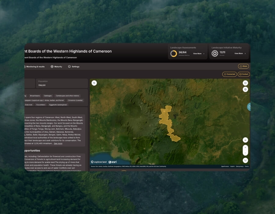
Hommes & Terre uses explorer.land to present its restoration work through interactive maps, geolocated updates, photos, videos and project information. The platform gives the organisation a public space to show its projects in their real landscape context, without a custom-built website, bespoke development or manual map production.
A public profile for the organisation
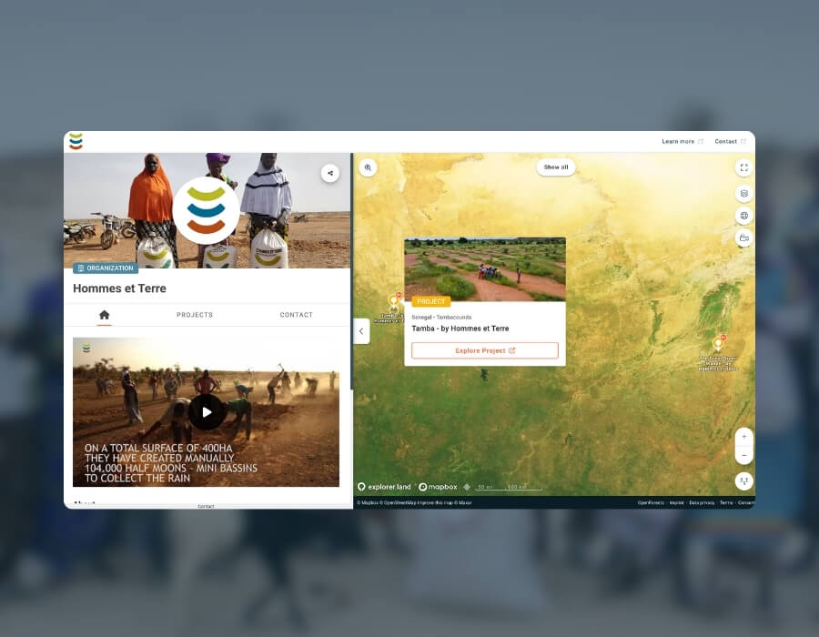
Hommes & Terre has a dedicated public profile on explorer.land where visitors can explore its mission, projects and restoration activities in one place. Instead of relying only on PDFs, presentations or scattered updates, the team can point funders, partners and other stakeholders to a single profile that brings its work together visually.

The Hommes & Terre organisation profile on explorer.land
Geolocated updates from the field
Photos, videos and short field reports are linked to specific locations on the map, building a visible timeline of restoration activities: community meetings, field preparation, planting, agroforestry work, soil and water interventions, monitoring and signs of ecological change. Funders and partners get a more continuous view of progress between formal reports.

Geolocated updates from Hommes & Terre project sites
Storytelling beyond hectares restored
Restoration work cannot be fully explained through numbers alone. On explorer.land, Hommes & Terre shows the human and ecological dimensions of its projects together: degraded land, restored vegetation, local participation, community governance, livelihoods, soil recovery and biodiversity. Restoration comes across as a living process rather than a single metric.
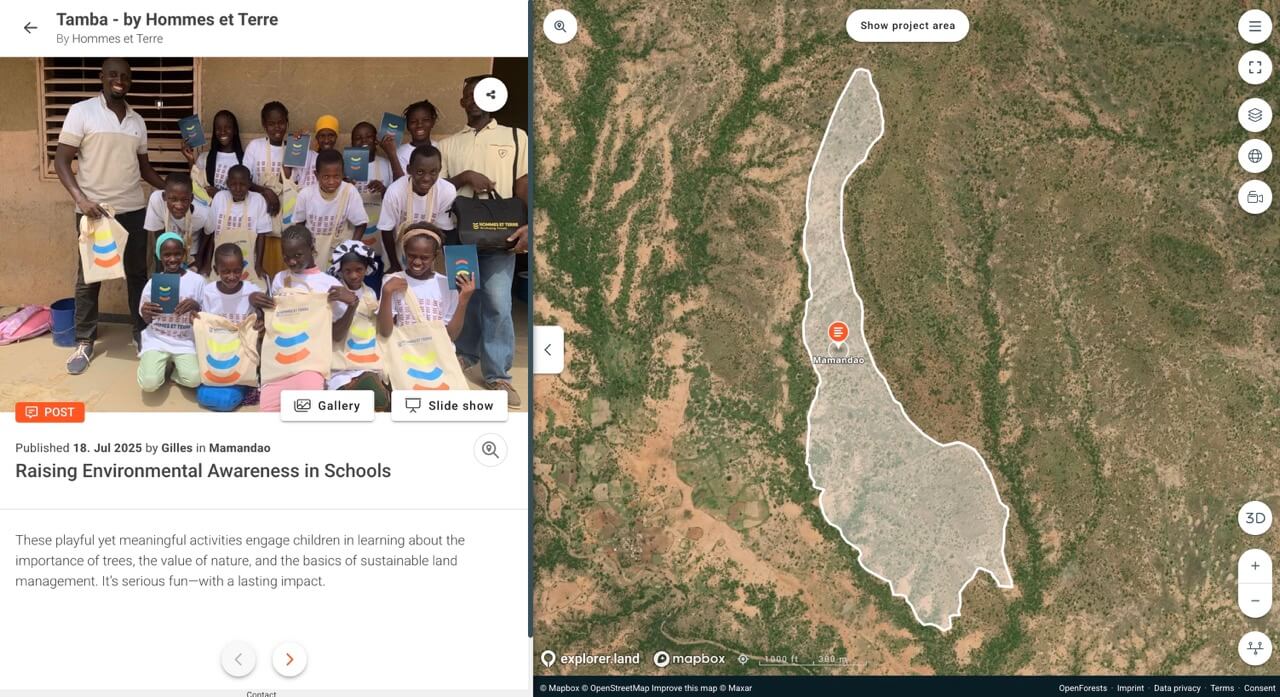
Geo-located updates from the field
A clearer public window into community-led landscape restoration
The restoration work of Hommes & Terre is now more visible, easier to understand and easier to follow for anyone who wants to see it.
“explorer.land is a way to really show to investors and funders that we are doing work on the ground, it’s not just a nice presentation, there is real stuff going on.”
Gilles Vanermen · Head of Project Development · Hommes & Terre
76 sites on one public map
Two projects and 76 sites in Senegal and Mali are mapped, showing where restoration takes place and what field activities are under way.
A public layer around complex fieldwork
Hommes & Terre has a simple way to show how degraded landscapes are being restored and how communities are involved.
A clearer view for funders and partners
Funders and partners can see what is happening on the ground, how ecological and social outcomes connect, and how progress develops over time.
Organisations running long-term, community-led restoration
Community-led restoration produces change that is slow, spread across large areas and partly social, which makes it hard to show through reports alone. A public map with geolocated field updates lets funders and partners follow that work as it happens.
- You restore land across several sites or countries and want one place to show it
- Your impact includes community and social outcomes, not only hectares
- You want funders to see progress between formal reports
Is your restoration work easier to see in the field than in your reports?
OpenForests helps restoration and conservation organisations map, monitor and report their work.