Forest inventory information is very important, especially during the first months and years after the plantation establishment. Having information about the mortality and growth dynamics of the plantation supports improved decision-making related to replanting, soil improvement, and early thinning activities.
In the past, forest inventories have been time-consuming and came at a relatively high cost. Field operator teams had to walk through the plantation and manually conducted their measurements, which significantly limited the coverage per time.
Though, recent technological developments, like drones and high computational power, have enabled the development of more efficient forest monitoring approaches. With drones, it has become possible to capture areas of several hundred hectares a day and carry out automated tree measurements.
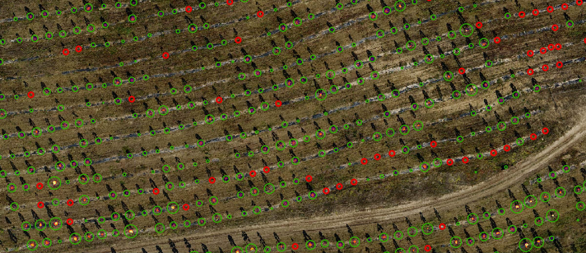
In this case study, we have carried out an automated tree inventory for a young tree plantation in Bulgaria based on high-resolution drone imagery.
Based on this imagery, a detailed Digital Surface Model was created in which the trees stand out from the background of the terrain. With the help of a set of algorithms, individual trees were isolated, their position and size determined. The extracted data was exported into standard shapefiles for further forest statistic analysis in GIS software.
Especially for plantation management drones can help to efficiently collect inventory data. There are various possibilities to derive inventory data from photo mosaics as well as from 3D models. – Dr. Patrick Ribeiro, CEO and Co-Founder, OpenForests
The goal of the explorer.land platform is to support projects with a comprehensive presentation tool that improves their visibility for collaborators, investors, donors, and product buyers by creating transparency and conveying the human dimension inherent in each project.