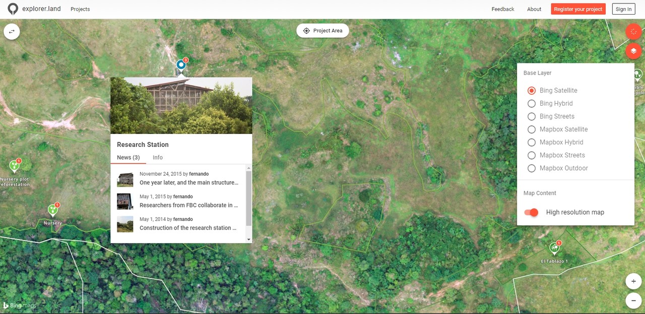
The beauty of web maps is that they allow us like no other medium to tell the story of a forest landscape project in multi-dimensions.
Only during the last few years has web technology enabled us to use maps more interactively and connect multimedia and data.
Context in space and time
Mapping portals allow us to place our stories in the context of the entire project, on a map. They enable us to show the different locations, the geographic context and visualize the project impact on the landscape with high-resolution satellite or drone imagery (before and after).
Transparency with multi-data layers
High-quality landscape projects already have a lot of management information. With the help of interactive maps, projects can open this source of data to the public and provide evidence for progress on the ground.
For this, projects can use various information layers:
- high-resolution drone and satellite imagery,
- polygons showing the planting sites,
- forest inventory surveys displaying tree position, diameter, height,
- geolocalized photos, videos, and blog posts.
Data, combined with visual information, enables a deep and multifaceted inside. A project is able to show their planting success, where the trees are planted, how many were planted with the year, who planted them, how much they have grown.
Projects can raise the bar to a level of ultimate transparency and clearly distinguish them as one that is legitimate and high-quality.
Stand out and build trust!
Free exploration
As a communicator of landscape projects, you have all the tools at your fingertips to make it exciting to show your project data and stories on an interactive web map. You can enable your audience to freely explore your project. This experience creates a deeper understanding of the project structure, and hence better transparency and more trust.
Take away:
- Like no other tool, interactive maps can support communications about a project from multiple dimensions: space, time, multimedia, and data.
- By connecting various information and data, like high-resolution maps, polygons of the project locations, monitoring data, photos, etc. transparency is highly increased.
- Free exploration of project information is part of the transparency strategy and allows a better understanding of project conditions while leading to more trust.
If you want to improve your own storytelling skills then please download our free “Storytelling Guide for Landscape Projects”